We have collected some beneficial maps of Gansu, including Gansu Tourism, geographical maps, travel maps, Lanzhou, Dunhuang, and Jiayuguan tourist maps, all of which are printable, to help you better understand Gansu Province, more easily plan Gansu tourism, we have collected some beneficial maps of Gansu.
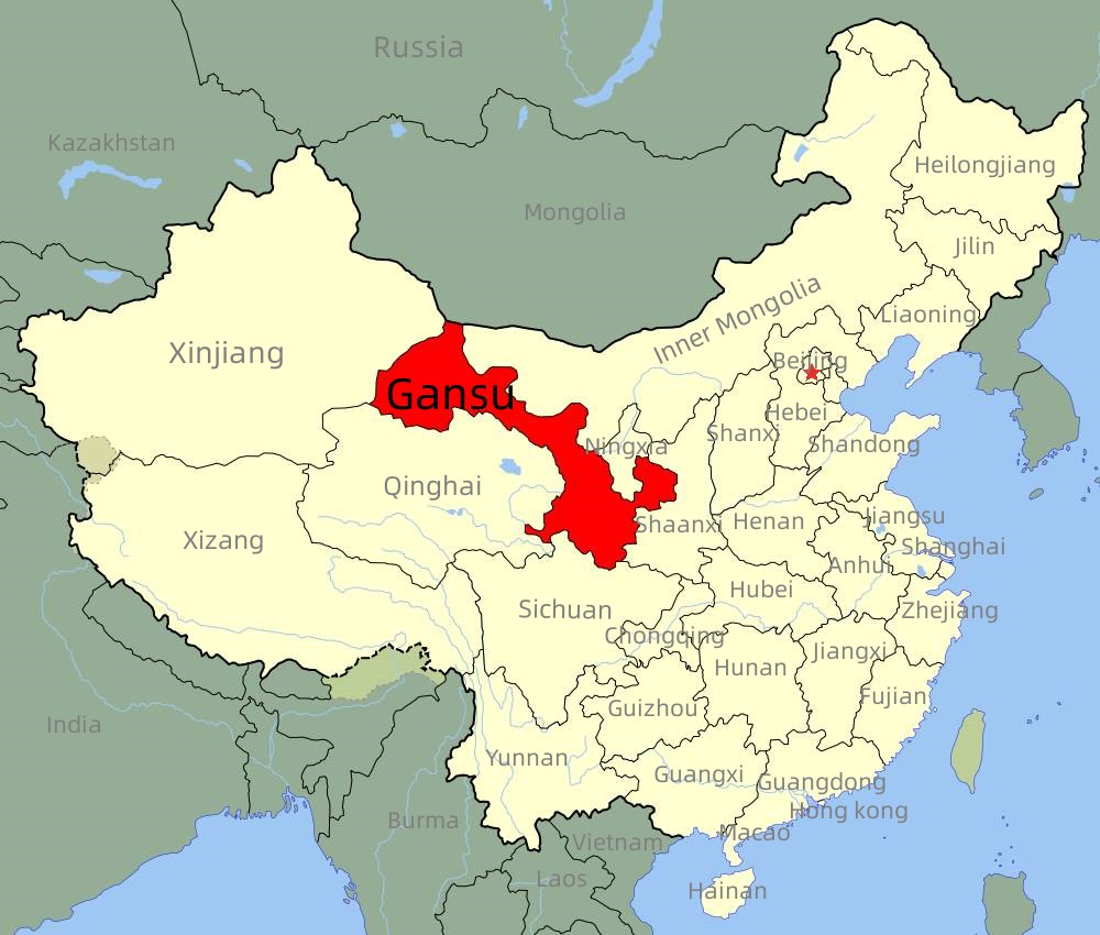
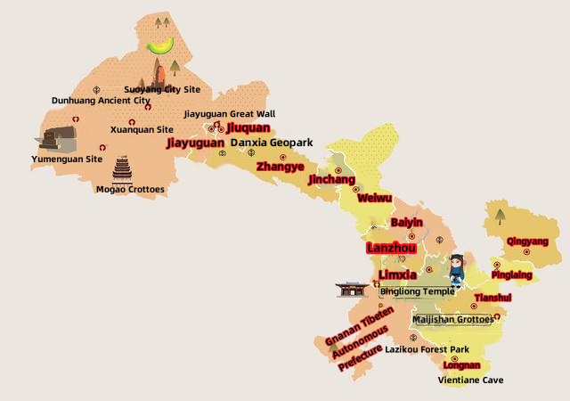
Gansu is located in northwest China, bordered by Shaanxi to the east, Sichuan and Qinghai to the south, Xinjiang to the west, and Inner Mongolia and Ningxia to the north. Gansu's topography is long and narrow, with a total area of 425,800 square meters. Gansu Province has jurisdiction over 12 prefecture-level cities and two autonomous prefectures. It is a multi-ethnic place. The main nationalities are Han, Hui, Tibetan, Tu, Miao, Manchu, Yi, Mongolian, and Tibetan. The 1,000-year-old Mogao Grottoes in Dunhuang and the colorful Danxia in Zhangye with its strange landform are both represented on this map.
Gansu, the origin of Lanzhou beef noodles, is a place full of charm and history. The ancient Silk Road has left many ancient cultural sites and magnificent ancient buildings here, such as the Mogao Grottoes and Jiayuguan Pass, which are historical and cultural treasures of China. Lianshan Mountain, Yellow River stone Forest, Zhangye colorful Danxia, and other magnificent natural landscapes make Gansu unique.
Gansu Tourism Map
The Silk Road not only promoted the economic development of Gansu but also promoted the development of tourism. Along the Silk Road, the scenery is constantly changing, from ancient cultural sites to stunning natural landscapes. Due to the diversity of climate in Gansu, the natural landscape of each place is different. Gansu has dry weather, cold in winter, hot in summer, and little precipitation. As a result, it has formed natural landscapes such as the Mogao Grottoes in Dunhuang, the Crescent Lake, the colorful Danxia, and the Yadan Landform.
Gansu Touriam Map
Lanzhou Tourism Map
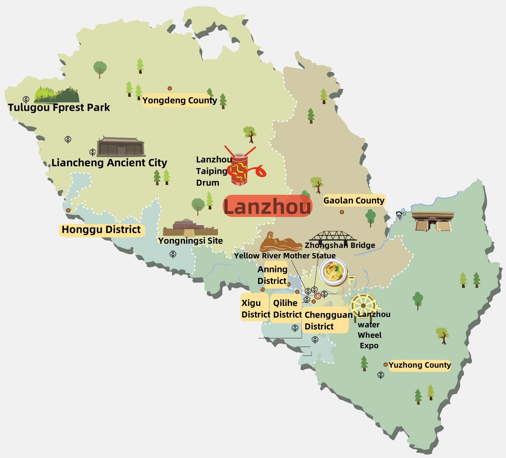
Lanzhou is the capital of Gansu Province. With a total area of 13,100 square kilometers, it has jurisdiction over 5 districts and 3 counties: Chengguan District, Qilihe District, Xigu District, Anning District, Honggu District , Yongdeng County, Yuzhong and Gaolan County. The permanent population of Lanzhou is about 4,425,100.
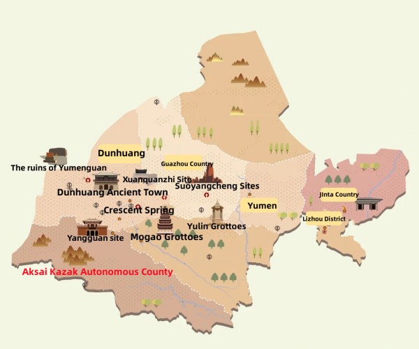
Jiuquan Tourism Map
Jiuquan has jurisdiction over 1 district, 2 county-level cities and 4 counties, with a total area of 192,000 square kilometers, accounting for 42% of the total area of Gansu Province, of which the total land area is 168,100 square kilometers, the wetland area is 48,000 square kilometers, and the cultivated land area is 460.04 million mu. By the end of 2022, Jiuquan has a permanent population of 1,053,100.
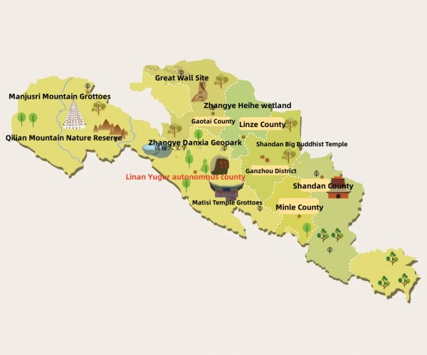
Zhnagye Tourism Map
Zhangye City has jurisdiction over 1 district and 5 counties, with a total area of 38,600 square kilometers.
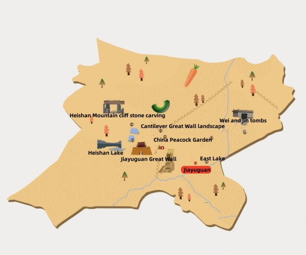
Jiayuguan Tourism Map
Jiayuguan City has jurisdiction over 2 streets and 3 towns, with a total area of 1224 square kilometers. As of the end of 2022, Jiayuguan's permanent population is 316,300.
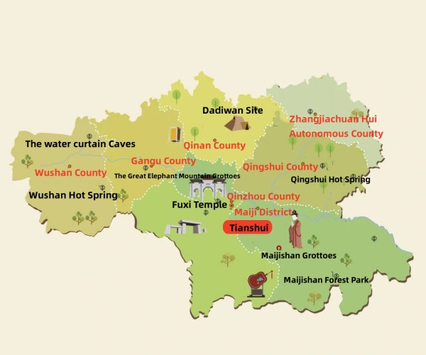
Tianshui Tourism Map
Tianshui Municipality has jurisdiction over 2 districts and 5 counties, with a total area of 14,300 square kilometers and a permanent population of 2,954,400.
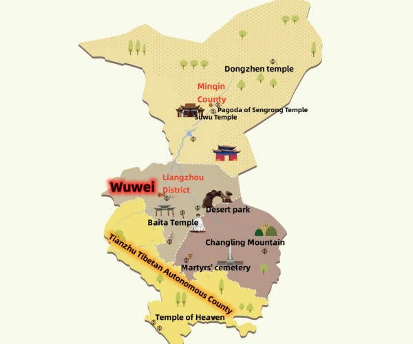
Wuwei Tourism Map
Wuwei Municipality has jurisdiction over 1 district, 2 counties and 1 autonomous county. The city has a permanent population of 1,445,100.
Gannan Tourism Map
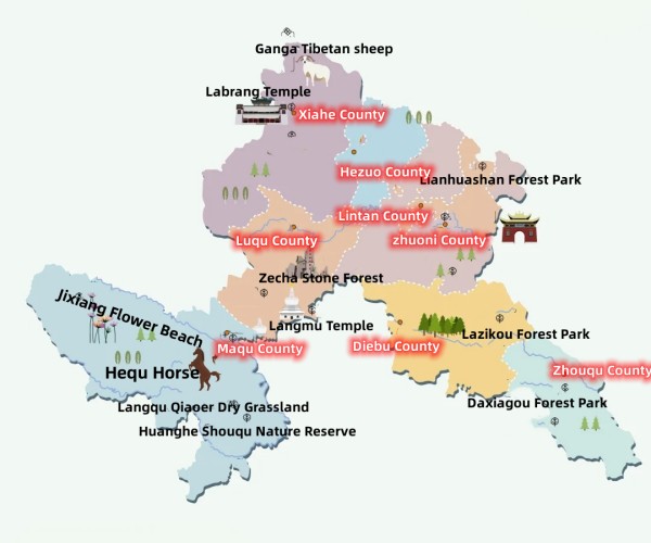
Gannan Tibetan Autonomous Prefecture has jurisdiction over 1 county-level city and 7 counties. The registered population of Nanzhou is 748,200, and the permanent population is 683,700.
